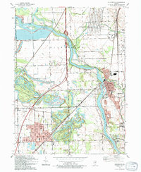
1993 Map of Wilmington
USGS Topo · Published 1994About this map
The Kankakee River winds through the heart of this landscape, serving as a geographic anchor for the riverfront communities of Wilmington and Lakewood Shores. To the south, the industrial and residential grid of Braidwood reveals a town shaped by its proximity to the railroad and former mining lands, evidenced by the local geography of Strip Mine Road and the nearby Claypool Ditch. The northeastern corner of the map is dominated by the sprawling Joliet Ammunition Plant, a massive military reservation boundary that contrasts sharply with the nearby Des Plaines State Conservation Area.
Find a feature on this map
61 named features on this map. Tap any name to fly to it.
Don’t see what you’re looking for? This feature index may not catch every label — zoom into the map to look around manually.
Map Details
Editions of this 1993 Wilmington Map
This is the sole edition of this map. No revisions or reprints were ever made.
Other maps of this area

1892 · Morris
USGS Topo · 1:62,500

1892 · Wilmington
USGS Topo · 1:62,500

1918 · Wilmington
USGS Topo · 1:62,500

1918 · Morris
USGS Topo · 1:62,500

1923 · Herscher
USGS Topo · 1:62,500

1925 · Herscher
USGS Topo · 1:62,500

1948 · Dwight
USGS Topo · 1:62,500

1950 · Dwight
USGS Topo · 1:62,500

1953 · Coal City
USGS Topo · 1:24,000

1953 · Symerton
USGS Topo · 1:24,000