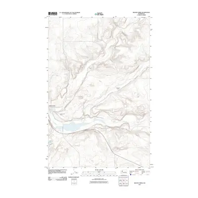
2011 Map of Wilson Creek
USGS Topo · Published 2011About this map
Wilson Creek sits at the confluence of several vital watercourses, where the stream of the same name meets Crab Creek in a deeply carved basin. This 2011 survey illustrates the town's grid and its proximity to the Wilson Creek Airport, reflecting the layout of a rural Grant County transportation hub. The surrounding landscape is defined by the broad Canniwai Valley, through which Canniwai Creek flows towards the southwest. To the north, the Bennett Dam and several irrigation roads like Bennett Rd and Road T NE trace the agricultural infrastructure of the region. The map also shows Soda Lake at the southern edge, highlighting the varying water levels and terrain typical of the Coulee country. Local street names such as Railroad St point toward the town's historical reliance on the rail lines that parallel the main creek beds.
Find a feature on this map
21 named features on this map. Tap any name to fly to it.
Don’t see what you’re looking for? This feature index may not catch every label — zoom into the map to look around manually.
Map Details
Editions of this 2011 Wilson Creek Map
This is the sole edition of this map. No revisions or reprints were ever made.
Other maps of this area

1953 · Ritzville
USGS Topo · 1:250,000

1956 · Wilson Creek SW
USGS Topo · 1:24,000

1956 · Wilson Creek SE
USGS Topo · 1:24,000

1956 · Wilson Creek NW
USGS Topo · 1:24,000

1956 · Wilson Creek
USGS Topo · 1:62,500

1959 · Ritzville
USGS Topo · 1:250,000

1965 · Ritzville
USGS Topo · 1:250,000

1968 · Marlin SW
USGS Topo · 1:24,000

1968 · Hartline SW
USGS Topo · 1:24,000

1968 · Marlin
USGS Topo · 1:24,000