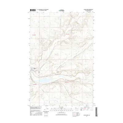
2017 Map of Wilson Creek
USGS Topo · Published 2017About this map
The settlement of Wilson Creek serves as the focal point of this Eastern Washington landscape, situated at the confluence where the waters of Wilson Cr meet the larger drainage of Crab Cr. The town's grid is clearly defined by historical thoroughfares like Main St, Spokane St, and Sprague St, reflecting its role as a local transportation hub. The presence of the BNSF Railway and the Wilson Creek Airport underscores the enduring importance of this corridor for regional transit and commerce.
Find a feature on this map
33 named features on this map. Tap any name to fly to it.
Don’t see what you’re looking for? This feature index may not catch every label — zoom into the map to look around manually.
Map Details
Editions of this 2017 Wilson Creek Map
This is the sole edition of this map. No revisions or reprints were ever made.
Other maps of this area

1953 · Ritzville
USGS Topo · 1:250,000

1956 · Wilson Creek SW
USGS Topo · 1:24,000

1956 · Wilson Creek SE
USGS Topo · 1:24,000

1956 · Wilson Creek NW
USGS Topo · 1:24,000

1956 · Wilson Creek
USGS Topo · 1:62,500

1959 · Ritzville
USGS Topo · 1:250,000

1965 · Ritzville
USGS Topo · 1:250,000

1968 · Marlin SW
USGS Topo · 1:24,000

1968 · Hartline SW
USGS Topo · 1:24,000

1968 · Marlin
USGS Topo · 1:24,000