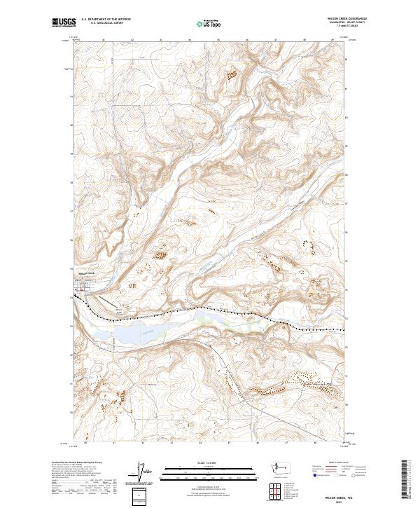
2023 Map of Wilson Creek
USGS Topo · Published 2023About this map
The town of Wilson Creek sits at a strategic junction where the namesake stream meets the wider drainage of Crab Creek in Grant County. This high-desert landscape is defined by the sharp coulee systems typical of Eastern Washington, including the expansive Canniwai Valley and the smaller drainage of Canniwai Creek to the northeast. The settlement pattern follows the floor of these valleys, with the town center laid out on a grid including Main St, Railroad St, and Spokane St. Significant local infrastructure includes the Wilson Creek Airport and several major rural thoroughfares like Kanniwai Rd and Black Rock Rd. To the southwest, the waters of Soda Lake mark a distinct hydrological feature within the arid terrain, illustrating the critical role of water management and natural catchments in this region's development.
Find a feature on this map
34 named features on this map. Tap any name to fly to it.
Don’t see what you’re looking for? This feature index may not catch every label — zoom into the map to look around manually.
Map Details
Editions of this 2023 Wilson Creek Map
This is the sole edition of this map. No revisions or reprints were ever made.
Other maps of this area

1953 · Ritzville
USGS Topo · 1:250,000

1956 · Wilson Creek SW
USGS Topo · 1:24,000

1956 · Wilson Creek SE
USGS Topo · 1:24,000

1956 · Wilson Creek NW
USGS Topo · 1:24,000

1956 · Wilson Creek
USGS Topo · 1:62,500

1959 · Ritzville
USGS Topo · 1:250,000

1965 · Ritzville
USGS Topo · 1:250,000

1968 · Marlin SW
USGS Topo · 1:24,000

1968 · Hartline SW
USGS Topo · 1:24,000

1968 · Marlin
USGS Topo · 1:24,000