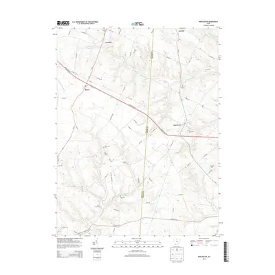
2013 Map of Winchester
USGS Topo · Published 2013About this map
Winchester and the surrounding rural landscapes of Adams and Brown Counties are documented here as they appeared in the early 21st century. The map reveals a high density of small family and community burial grounds, such as Wilson Cem, Horner Cem, and Independence Cem, which dot the upland ridges between significant watercourses like the W Fork Ohio Brush Cr and Elk Fork. This concentration of cemeteries provides a valuable spatial record for genealogists tracing ancestral lines in the settlements of Fincastle, Macon, and Emerald. The local topography is defined by the transition from agricultural plateaus to the drainages of the W Fork Eagle Cr, with Carson Hill standing as a notable point of elevation. Modern infrastructure, specifically the Appalachian Hwy and Us-62, cuts through the older grid of country lanes like Dixon Rd and Burton Rd.
Find a feature on this map
65 named features on this map. Tap any name to fly to it.
Don’t see what you’re looking for? This feature index may not catch every label — zoom into the map to look around manually.
Map Details
Editions of this 2013 Winchester Map
This is the sole edition of this map. No revisions or reprints were ever made.
Other maps of this area

1917 · Hillsboro
USGS Topo · 1:62,500

1917 · Sardinia
USGS Topo · 1:62,500

1918 · Seaman
USGS Topo · 1:62,500

1928 · Higginsport
USGS Topo · 1:48,000

1931 · Higginsport
USGS Topo · 1:62,500

1944 · Hillsboro
USGS Topo · 1:62,500

1944 · Sardinia
USGS Topo · 1:62,500

1947 · Columbus
USGS Topo · 1:250,000

1957 · Huntington
USGS Topo · 1:250,000

1960 · Huntington
USGS Topo · 1:250,000