1955 Map of Windsor
USGS Topo · Published 1982About this map
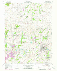
The town of Windsor serves as a central hub at the junction of several Missouri counties, defined by its position at the intersection of the Missouri Kansas Texas and St Louis Southwestern railroads. The 1955 landscape shows a community built on a mixture of agriculture and extractive industry, evidenced by numerous strip mines and mine dumps that dot the terrain around Bowen and Sutherland. This map reveals the rural infrastructure of the mid-20th century, including landmarks like the Windsor Fairgrounds and Farrington Park, alongside essential social nodes such as High Point Ch, Liberty Ch, and localized education centers like Sunny Side Sch. The presence of several family-named burial grounds, including Askins Cem and Cooper Cem, provides specific touchpoints for genealogical research in this multi-county border region.
Find a feature on this map
41 named features on this map. Tap any name to fly to it.
Don’t see what you’re looking for? This feature index may not catch every label — zoom into the map to look around manually.
Map Details
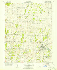
Editions of this 1955 Windsor Map
2 editions found
Other maps of this area

1885 · Warrensburg
USGS Topo · 1:125,000

1887 · Clinton
USGS Topo · 1:125,000

1887 · Sedalia
USGS Topo · 1:125,000

1887 · Warsaw
USGS Topo · 1:125,000

1887 · Warrensburg
USGS Topo · 1:125,000

1894 · Warsaw
USGS Topo · 1:125,000

1894 · Sedalia
USGS Topo · 1:125,000

1894 · Warrensburg
USGS Topo · 1:125,000

1894 · Clinton
USGS Topo · 1:125,000

1947 · Jefferson City
USGS Topo · 1:250,000