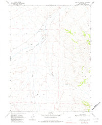
1968 Map of Wine Cup Ranch NE
USGS Topo · Published 1982About this map
Thousand Springs Valley defines the topography of this high-desert region in northeastern Elko County, where the hydrology is marked by ephemeral drainages and intermittent water sources. The landscape is characterized by the confluence of Thousand Springs Creek with significant natural depressions such as Fivemile Draw and Toano Draw. Human presence in this arid environment is tied closely to ranching and local transit, anchored by the Fivemile Ranch and the Van Eaton settlement. Scattered infrastructure, including a Corral, several marked Springs, and a remote Jeep Trail, illustrates the logistical challenges of land management in the late 1960s. The map also records early industrial modifications in the form of multiple Borrow Pits, which often point to road maintenance or construction efforts in this expansive ranching corridor.
Find a feature on this map
14 named features on this map. Tap any name to fly to it.
Don’t see what you’re looking for? This feature index may not catch every label — zoom into the map to look around manually.
Map Details
Editions of this 1968 Wine Cup Ranch NE Map
2 editions found
Other maps of this area

1955 · Wells
USGS Topo · 1:250,000

1958 · Wells
USGS Topo · 1:250,000

1961 · Wells
USGS Topo · 1:250,000

1961 · Delano Mountains
USGS Topo · 1:62,500

1967 · Ninemile Mtn SW
USGS Topo · 1:24,000

1967 · Ninemile Mtn
USGS Topo · 1:24,000

1968 · Knoll Mountain
USGS Topo · 1:24,000

1968 · Knoll Mountain SE
USGS Topo · 1:24,000

1968 · Wine Cup Ranch SE
USGS Topo · 1:24,000

1968 · Wine Cup Ranch
USGS Topo · 1:24,000