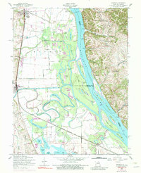
1954 Map of Winfield
USGS Topo · Published 1983About this map
The Mississippi River dominates this mid-century landscape, defining the boundary between Lincoln and St. Charles counties. The floodplains are a complex network of sloughs and lakes, including Argent Slough, Cuivre Slough, and Horseshoe Lake, protected in sections by an extensive levee system. Along the river’s eastern banks, river-dependent infrastructure like Dogtown Landing, Beech Landing, and Hastings Landing suggest the enduring importance of water transport, complemented by the West Point Ferry crossing near Cap au Gris.
Find a feature on this map
55 named features on this map. Tap any name to fly to it.
Don’t see what you’re looking for? This feature index may not catch every label — zoom into the map to look around manually.
Map Details
Editions of this 1954 Winfield Map
Other maps of this area

1903 · O'Fallon
USGS Topo · 1:125,000

1930 · Hardin
USGS Topo · 1:62,500

1931 · Brussels
USGS Topo · 1:62,500

1934 · Elsberry
USGS Topo · 1:48,000

1934 · Hardin
USGS Topo · 1:62,500

1938 · Hardin
USGS Topo · 1:62,500

1939 · Brussels
USGS Topo · 1:62,500

1941 · Troy
USGS Topo · 1:62,500

1942 · Elsberry
USGS Topo · 1:62,500

1943 · Brussels
USGS Topo · 1:62,500