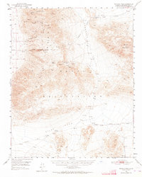
1950 Map of Wingate Pass
USGS Topo · Published 1964About this map
Mining operations and harsh desert terrain dominate this mid-century survey of the California desert. The Slate Range and the Panamint Valley define a landscape marked by industrial ambition and survival, evidenced by the numerous mining sites such as the Virginia Ann Mine, Sandora Mine, and New York Mine. A notable cultural feature is the Dismantled RR that once climbed toward Wingate Pass, indicating a shift in the local mineral economy as infrastructure was reclaimed by the desert. To the south, Pilot Knob Valley and Reservation Valley sit under the shadow of the Death Valley National Mon. boundary. The scarcity of water is starkly noted by labels such as Lone Willow Spring (undrinkable) and the isolated Layton Well, emphasizing the logistical challenges faced by those working the Deans Mill or seeking fortunes at the Ghost Mine.
Find a feature on this map
30 named features on this map. Tap any name to fly to it.
Don’t see what you’re looking for? This feature index may not catch every label — zoom into the map to look around manually.
Map Details
Editions of this 1950 Wingate Pass Map
3 editions found

Other maps of this area

1915 · Searles Lake
USGS Topo · 1:250,000

1933 · Avawatz Mountains
USGS Topo · 1:250,000

1947 · Trona
USGS Topo · 1:250,000

1948 · Trona
USGS Topo · 1:250,000

1948 · Quail Mountains
USGS Topo · 1:62,500

1948 · Goldstone Lake
USGS Topo · 1:62,500

1949 · Trona
USGS Topo · 1:62,500

1949 · Searles Lake
USGS Topo · 1:62,500

1950 · Searles Lake
USGS Topo · 1:62,500

1950 · Trona
USGS Topo · 1:62,500