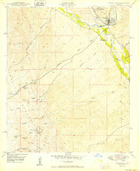
1950 Map of Winkelman
USGS Topo · Published 1950About this map
Mining operations and river junctions dominate this 1950 survey, where the Gila River meets the San Pedro River. The industrial landscape of Hayden is defined by a massive Tailings Pond and the Southern Pacific railroad infrastructure that serviced the region's copper interests. Just south of the mining hub, the town of Winkelman sits near the confluence, providing a clear view of the settlement patterns at the Gila Co Pinal Co boundary.
Find a feature on this map
37 named features on this map. Tap any name to fly to it.
Don’t see what you’re looking for? This feature index may not catch every label — zoom into the map to look around manually.
Map Details
Editions of this 1950 Winkelman Map
2 editions found
Other maps of this area

1910 · Ray
USGS Topo · 1:62,500

1911 · Winkelman
USGS Topo · 1:125,000

1913 · Winkelman
USGS Topo · 1:125,000

1915 · Christmas
USGS Topo · 1:62,500

1917 · Christmas
USGS Topo · 1:62,500

1949 · Holy Joe Peak
USGS Topo · 1:62,500

1949 · Crozier Peak
USGS Topo · 1:24,000

1949 · Winkelman
USGS Topo · 1:24,000

1949 · Winkelman
USGS Topo · 1:62,500

1949 · Saddle Mtn.
USGS Topo · 1:24,000