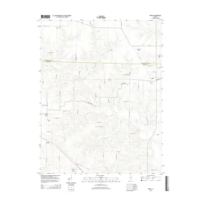
2015 Map of Winkle
USGS Topo · Published 2015About this map
The boundary between Washington and Perry counties divides this southern Illinois landscape, where small crossroads like Winkle and Rice serve as focal points for the surrounding rural tracts. The terrain is defined by low-lying prairies such as Threemile Prairie and Grande Cote Prairie, interspersed with a complex network of creeks including Swanwick Cr and Wolf Cr. This 2015 survey reveals a dense pattern of local roads, many named for flowers and local landmarks, which provide access to numerous family and community burial grounds like Maxwell Cem, Pilot Knob Cem, and Concord Baptist Cem. Near the southern edge, the Schumaker RLA Airport stands as a notable modern landmark. The map illustrates a region where agriculture and local heritage remain deeply intertwined, preserved through the maintenance of historical names and cemetery sites that date back many generations.
Find a feature on this map
67 named features on this map. Tap any name to fly to it.
Don’t see what you’re looking for? This feature index may not catch every label — zoom into the map to look around manually.
Map Details
Editions of this 2015 Winkle Map
This is the sole edition of this map. No revisions or reprints were ever made.
Other maps of this area

1910 · Okawville
USGS Topo · 1:62,500

1914 · Coulterville
USGS Topo · 1:62,500

1917 · Coulterville
USGS Topo · 1:62,500

1924 · Pinckneyville
USGS Topo · 1:62,500

1926 · Pinckneyville
USGS Topo · 1:62,500

1931 · Hoyleton
USGS Topo · 1:48,000

1932 · Nashville
USGS Topo · 1:62,500

1936 · Nashville
USGS Topo · 1:62,500

1940 · Okawville
USGS Topo · 1:62,500

1958 · Belleville
USGS Topo · 1:250,000