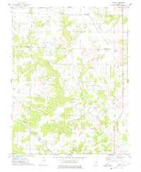
1974 Map of Winkle
USGS Topo · Published 1978About this map
The Illinois Central Gulf railroad cuts a diagonal path across the southwest corner of this 1970s landscape, serving as a primary transit artery for the small settlement of Winkle. Situated along the boundary of Washington and Perry Counties, the area transitions from the plateau of Grande Cote into a dense network of drainages including Swanwick Creek and Wolf Creek. This survey records a rural interior defined by family and community landmarks, from School No 212 to several scattered burial grounds like Maxwell Cem and Pilot Knob Cem.
Find a feature on this map
28 named features on this map. Tap any name to fly to it.
Don’t see what you’re looking for? This feature index may not catch every label — zoom into the map to look around manually.
Map Details
Editions of this 1974 Winkle Map
This is the sole edition of this map. No revisions or reprints were ever made.
Other maps of this area

1910 · Okawville
USGS Topo · 1:62,500

1914 · Coulterville
USGS Topo · 1:62,500

1917 · Coulterville
USGS Topo · 1:62,500

1924 · Pinckneyville
USGS Topo · 1:62,500

1926 · Pinckneyville
USGS Topo · 1:62,500

1931 · Hoyleton
USGS Topo · 1:48,000

1932 · Nashville
USGS Topo · 1:62,500

1936 · Nashville
USGS Topo · 1:62,500

1940 · Okawville
USGS Topo · 1:62,500

1958 · Belleville
USGS Topo · 1:250,000