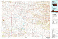
1986 Map of Winnett
USGS Topo · Published 1994About this map
The boundary between Fergus and Petroleum Counties splits a landscape defined by expansive drainage basins and the vestiges of early twentieth-century infrastructure. Small settlements such as Roy and Teigen anchor the western reaches, while the isolated community of Valentine sits among the northern coulees. The transportation history of the region is etched into the terrain by an Old Railroad Grade that parallels McDonald Creek, tracing the path of former rail lines that once connected these ranching hubs.
Find a feature on this map
30 named features on this map. Tap any name to fly to it.
Don’t see what you’re looking for? This feature index may not catch every label — zoom into the map to look around manually.
Map Details
Editions of this 1986 Winnett Map
This is the sole edition of this map. No revisions or reprints were ever made.
Other maps of this area

1889 · Big Snowy Mountain
USGS Topo · 1:250,000

1893 · Big Snowy Mountain
USGS Topo · 1:250,000

1941 · Judith Peak
USGS Topo · 1:62,500

1943 · Landusky
USGS Topo · 1:125,000

1944 · Judith Peak
USGS Topo · 1:62,500

1954 · Hessler Ridge
USGS Topo · 1:24,000

1954 · Carter Coulee
USGS Topo · 1:24,000

1954 · Jordan
USGS Topo · 1:250,000

1954 · Forsyth
USGS Topo · 1:250,000

1954 · Roundup
USGS Topo · 1:250,000