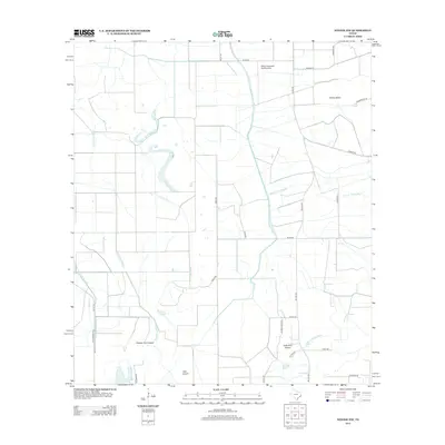
2013 Map of Winnie NW
USGS Topo · Published 2013About this map
Spindletop Bayou and a dense network of irrigation and drainage infrastructure define the agricultural landscape of this Jefferson County region in the early 21st century. The map reveals the intricate water management system essential to the area, including the Lower Neches Valley Authority Canal, Nolte Canal, and East Branch Devers Canal. These man-made waterways segment the coastal prairie, supporting the local economy while coexisting with natural drainages like the North Fork Taylor Bayou. Several named topographic elevations, or "islands," rise above the low-lying terrain, such as Turkey Island and Double Gum Island, providing historically significant landmarks for local navigation and land use. The presence of the Sonny Broussard Landing Strip in the northern portion of the quadrangle highlights the continued importance of private aviation in managing these expansive rural tracts.
Find a feature on this map
33 named features on this map. Tap any name to fly to it.
Don’t see what you’re looking for? This feature index may not catch every label — zoom into the map to look around manually.
Map Details
Editions of this 2013 Winnie NW Map
This is the sole edition of this map. No revisions or reprints were ever made.
Other maps of this area

1943 · Whites Bayou
USGS Topo · 1:24,000

1943 · Liberty
USGS Topo · 1:125,000

1943 · Stowell
USGS Topo · 1:24,000

1945 · Nolte
USGS Topo · 1:31,680

1950 · Houston
USGS Topo · 1:250,000

1954 · Beaumont
USGS Topo · 1:250,000

1955 · Daisetta
USGS Topo · 1:62,500

1955 · Sour Lake
USGS Topo · 1:62,500

1956 · Houston
USGS Topo · 1:250,000

1957 · Beaumont
USGS Topo · 1:250,000