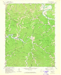
1972 Map of Winslow
USGS Topo · Published 1973About this map
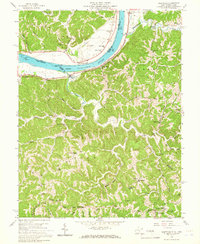
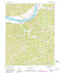
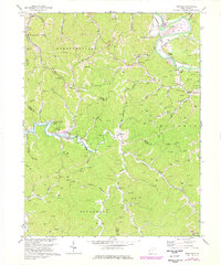
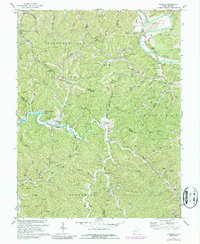
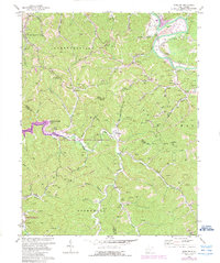
The Guyandotte River valley and its surrounding hillsides define this early 1970s landscape, where natural resource extraction and rural settlement coincide. A significant infrastructure transition is documented by the blue hatching around the Beech Fork and its tributaries, marking the area designated to be submerged by the creation of Beech Fork Lake. This inundation zone reaches toward the community of Bowen, covering numerous small creek branches and low-lying fields. On the higher ground, a dense network of gas wells and a prominent pipeline corridor illustrate the region's energy production history. Traditional community life is anchored by landmarks like Mays Chapel, McComas Sch, and family sites such as the Wallace Cem. The Chesapeake and Ohio railroad follows the river's bend near Owens Crossing, while the southern reaches feature the Lookout Tower near the Sheridan boundary.
Find a feature on this map
63 named features on this map. Tap any name to fly to it.
Don’t see what you’re looking for? This feature index may not catch every label — zoom into the map to look around manually.
Map Details
Editions of this 1972 Winslow Map
4 editions found
Historical Maps of Winslow Through Time
9 maps found