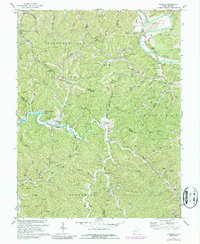
1972 Map of Winslow
USGS Topo · Published 1987About this map
The development of Beech Fork Lake is a central feature of this landscape on the border of Cabell and Wayne counties, with blue hatching indicating areas designated for controlled inundation. This transformation of the terrain around Bowen and the Beech Fork waterway altered the local geography as the reservoir was established. Further north, the Guyandotte River winds toward the Mud River, flanked by the Chesapeake and Ohio railroad and the Ohio River Road.
Find a feature on this map
50 named features on this map. Tap any name to fly to it.
Don’t see what you’re looking for? This feature index may not catch every label — zoom into the map to look around manually.
Map Details
Editions of this 1972 Winslow Map
4 editions found
Other maps of this area

1892 · Huntington
USGS Topo · 1:125,000

1898 · Huntington
USGS Topo · 1:125,000

1901 · Guyandot
USGS Topo · 1:62,500

1902 · Guyandot
USGS Topo · 1:62,500

1902 · Milton
USGS Topo · 1:62,500

1902 · Midkiff
USGS Topo · 1:62,500

1907 · Midkiff
USGS Topo · 1:62,500

1909 · Wayne
USGS Topo · 1:62,500

1909 · Midkiff
USGS Topo · 1:62,500

1931 · Wayne
USGS Topo · 1:62,500