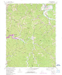
1972 Map of Winslow
USGS Topo · Published 1989About this map
The Guyandotte River winds through the northern reach of this quadrangle, forming a natural corridor for the Owens Crossing settlement and the adjacent Golf Course. In the early 1970s, the terrain south of the river is defined by a dense network of creek valleys and ridges, including Bowen Ridge and Hickory Ridge, which are dotted with numerous gas wells. The landscape shows a rural community structure centered around small settlements like Winslow, Macedonia, and Sarah. The southwestern corner is dominated by the Beech Fork Lake and the Beech Fork Lake Public Hunting and Fishing Area, highlighting the region's shift toward managed recreation. Genealogists will find several family burial sites, such as Crooks Cem and Wallace Cem, alongside local institutions like McComas Sch and Green Valley Chapel.
Find a feature on this map
48 named features on this map. Tap any name to fly to it.
Don’t see what you’re looking for? This feature index may not catch every label — zoom into the map to look around manually.
Map Details
Editions of this 1972 Winslow Map
4 editions found
Other maps of this area

1892 · Huntington
USGS Topo · 1:125,000

1898 · Huntington
USGS Topo · 1:125,000

1901 · Guyandot
USGS Topo · 1:62,500

1902 · Guyandot
USGS Topo · 1:62,500

1902 · Milton
USGS Topo · 1:62,500

1902 · Midkiff
USGS Topo · 1:62,500

1907 · Midkiff
USGS Topo · 1:62,500

1909 · Wayne
USGS Topo · 1:62,500

1909 · Midkiff
USGS Topo · 1:62,500

1931 · Wayne
USGS Topo · 1:62,500