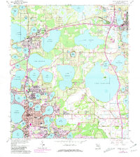
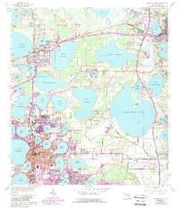
1959 Map of Winter Haven
USGS Topo · Published 1981About this map
Winter Haven and Haines City anchor this citrus-belt landscape during a period of significant mid-century expansion. The map details a complex hydrological network where residential growth and agricultural research intersect, evidenced by the Univ of Fla Exper Sta and the Dept of Agriculture Research Lab. Urban footprints extend toward smaller communities like Florence Villa and Dundee, while the Seaboard Coast Line railroad creates a transit spine through the lake-dotted terrain. Neighborhood infrastructure is deeply visible, from the Jewett High Sch to local landmarks like the Amphitheater and Drive-in Theater. The map captures the transition of formerly open land into leisure and residential spaces, including the Lake Region Golf Club and Lakeside Memorial Park, all set against a backdrop of dozens of named water bodies like Lake Haines and Lake Hamilton.
Find a feature on this map
103 named features on this map. Tap any name to fly to it.
Don’t see what you’re looking for? This feature index may not catch every label — zoom into the map to look around manually.
Map Details
Editions of this 1959 Winter Haven Map
5 editions found
Other maps of this area

1944 · Polk City
USGS Topo · 1:31,680

1944 · Auburndale
USGS Topo · 1:31,680

1949 · Bartow
USGS Topo · 1:24,000

1950 · Bartow
USGS Topo · 1:24,000

1952 · Lake Wales
USGS Topo · 1:24,000

1953 · Dundee
USGS Topo · 1:24,000

1953 · Davenport
USGS Topo · 1:24,000

1955 · Eloise
USGS Topo · 1:24,000

1955 · Orlando
USGS Topo · 1:250,000

1956 · Fort Pierce
USGS Topo · 1:250,000