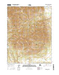
2016 Map of Wiseman A-5 NE
USGS Topo · Published 2016About this map
Malamute Fork winds through the southern reaches of this interior Alaskan landscape, which is defined by significant elevation changes and deep drainages. The topography here is part of the larger Yukon-Koyukuk region, where watercourses like Missouri Cr and Midas Cr have carved distinct paths through the high terrain. The map details the transition between several township and range boundaries, including t28n r21w, which helps orient researchers to the underlying Public Land Survey System. There are no marked settlements or structures on this sheet, indicating a region that remained predominantly undeveloped and focused on its natural hydrology well into the twenty-first century. The intricate contour lines illustrate the steep drainage basins that feed into the larger river systems of the Alaskan north.
Find a feature on this map
7 named features on this map. Tap any name to fly to it.
Don’t see what you’re looking for? This feature index may not catch every label — zoom into the map to look around manually.
Map Details
Editions of this 2016 Wiseman A-5 NE Map
This is the sole edition of this map. No revisions or reprints were ever made.
Other maps of this area

1951 · Wiseman
USGS Topo · 1:250,000

1956 · Wiseman
USGS Topo · 1:250,000

1964 · Wiseman
USGS Topo · 1:250,000

1970 · Wiseman A-4
USGS Topo · 1:63,360

1970 · Wiseman A-5
USGS Topo · 1:63,360
1971 · Wiseman B-5
USGS Topo · 1:63,360
1971 · Wiseman B-4
USGS Topo · 1:63,360
2016 · Wiseman B-5 SW
USGS Topo · 1:25,000
2016 · Wiseman B-4 SW
USGS Topo · 1:25,000
2016 · Wiseman A-4 NW
USGS Topo · 1:25,000