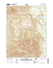
2016 Map of Wiseman B-5 SE
USGS Topo · Published 2016About this map
The John River dominates the eastern drainage of this interior landscape, weaving through a valley bounded by steep rises and a series of named alpine creeks. To the northeast, the presence of the Crevice Creek Airport near Crevice Cr indicates a critical point of access for bush pilots and regional transport in a terrain where traditional roads are absent. The map illustrates a complex network of seasonal watercourses, including Sixtymile Cr and Midas Cr, which feed into the primary river system. This 2016 survey documents the precise topography of the Brooks Range foothills, showcasing the relationship between high-altitude ridges and the braided river channels below. The landscape remains largely defined by its natural hydrology, from Grizzly Cr in the center to Missouri Cr along the southern boundary.
Find a feature on this map
14 named features on this map. Tap any name to fly to it.
Don’t see what you’re looking for? This feature index may not catch every label — zoom into the map to look around manually.
Map Details
Editions of this 2016 Wiseman B-5 SE Map
This is the sole edition of this map. No revisions or reprints were ever made.
Other maps of this area

1951 · Wiseman
USGS Topo · 1:250,000

1956 · Wiseman
USGS Topo · 1:250,000

1964 · Wiseman
USGS Topo · 1:250,000

1970 · Wiseman A-4
USGS Topo · 1:63,360

1970 · Wiseman A-5
USGS Topo · 1:63,360
1971 · Wiseman B-5
USGS Topo · 1:63,360
1971 · Wiseman B-4
USGS Topo · 1:63,360
2016 · Wiseman B-5 SW
USGS Topo · 1:25,000
2016 · Wiseman B-4 SW
USGS Topo · 1:25,000
2016 · Wiseman A-4 NW
USGS Topo · 1:25,000