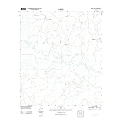
2013 Map of Wolf Hill
USGS Topo · Published 2013About this map
The Neches River meanders across this East Texas landscape, creating a complex network of tributaries such as Biloxi Cr, Piney Cr, and Caney Cr. The terrain is defined by its water systems and the prominent rise of Wolf Hill, which serves as a vantage point for the Wolf Hill Lookout Tower. The area is characterized by a sparse, rural settlement pattern connected by a web of county roads, including Weaver Bend Rd and Grimes Flournoy Rd. Local history is preserved in several family-named burial sites scattered throughout the quadrangle, notably Crain Cem, Havard Cem, and Futch Cem. This 2013 survey provides a detailed view of the contemporary riparian environment and the persisting landmarks of Angelina County's rural communities.
Find a feature on this map
49 named features on this map. Tap any name to fly to it.
Don’t see what you’re looking for? This feature index may not catch every label — zoom into the map to look around manually.
Map Details
Editions of this 2013 Wolf Hill Map
This is the sole edition of this map. No revisions or reprints were ever made.
Other maps of this area

1927 · Lufkin 4-c
USGS Topo · 1:24,000

1928 · Zavalla 3-c
USGS Topo · 1:24,000

1928 · Lufkin 4-d
USGS Topo · 1:24,000

1931 · Zavalla
USGS Topo · 1:62,500

1932 · Manning
USGS Topo · 1:62,500

1953 · Palestine
USGS Topo · 1:250,000

1954 · Beaumont
USGS Topo · 1:250,000

1955 · Woodville
USGS Topo · 1:62,500

1955 · Camden
USGS Topo · 1:62,500

1957 · Beaumont
USGS Topo · 1:250,000