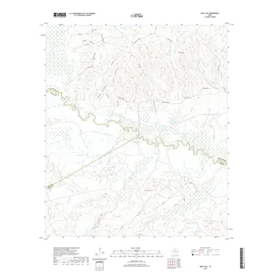
2019 Map of Wolf Hill
USGS Topo · Published 2019About this map
The Neches River winds through a dense network of bottomlands and wetlands at the intersection of Angelina, Polk, and Tyler counties. This landscape is defined by its complex drainage, where numerous waterways like Piney Cr, Biloxi Cr, and Russell Cr converge toward the primary river channel. Higher ground to the north is marked by Wolf Hill and a series of rural roads, including Weaver Bend Rd and FM 844, which connect scattered family landmarks. Genealogists will find significant value in the distribution of several rural burial sites, such as Crain Cem, Page Cem, Havard Cem, Barclay Cem, and Futch Cem. The map illustrates a contemporary view of the East Texas Piney Woods, where timber interests and private holdings like the Pine Aire Plantation Pvt dominate the upland terrain while the river valley remains a largely roadless floodplain.
Find a feature on this map
54 named features on this map. Tap any name to fly to it.
Don’t see what you’re looking for? This feature index may not catch every label — zoom into the map to look around manually.
Map Details
Editions of this 2019 Wolf Hill Map
This is the sole edition of this map. No revisions or reprints were ever made.
Other maps of this area

1927 · Lufkin 4-c
USGS Topo · 1:24,000

1928 · Zavalla 3-c
USGS Topo · 1:24,000

1928 · Lufkin 4-d
USGS Topo · 1:24,000

1931 · Zavalla
USGS Topo · 1:62,500

1932 · Manning
USGS Topo · 1:62,500

1953 · Palestine
USGS Topo · 1:250,000

1954 · Beaumont
USGS Topo · 1:250,000

1955 · Woodville
USGS Topo · 1:62,500

1955 · Camden
USGS Topo · 1:62,500

1957 · Beaumont
USGS Topo · 1:250,000