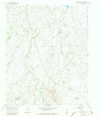
1966 Map of Wolf Mountain
USGS Topo · Published 1981About this map
Fryingpan Ranch and Word Ranch anchor this mid-1960s landscape in Potter County, where the high plains break into the drainage systems of the Canadian River valley. The terrain is defined by prominent elevations such as Wolf Mountain and Goat Mountain, while Coyote Bluff stands over the western canyons. The Fort Worth and Denver railroad cuts a straight line through the central section, providing a stark industrial contrast to the winding paths of Tecovas Creek and Pedrosa Creek.
Find a feature on this map
16 named features on this map. Tap any name to fly to it.
Don’t see what you’re looking for? This feature index may not catch every label — zoom into the map to look around manually.
Map Details
Editions of this 1966 Wolf Mountain Map
2 editions found
Other maps of this area

1934 · Ady
USGS Topo · 1:62,500

1934 · Cliffside
USGS Topo · 1:62,500

1936 · Cliffside
USGS Topo · 1:62,500

1936 · Ady
USGS Topo · 1:62,500

1953 · Puente
USGS Topo · 1:24,000

1953 · Cliffside
USGS Topo · 1:24,000

1954 · Tucumcari
USGS Topo · 1:250,000

1954 · Amarillo
USGS Topo · 1:250,000

1958 · Amarillo
USGS Topo · 1:250,000

1958 · Tucumcari
USGS Topo · 1:250,000