1985 Map of Wolfforth
USGS Topo · Published 1985About this map
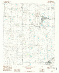
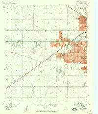
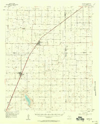
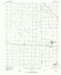
Reese Air Force Base dominates the northeastern portion of this High Plains landscape, reflecting the military's significant presence in the region during the mid-1980s. Adjacent to the base, Reese Village and the settlement of Hurlwood suggest a community closely tied to the installation, supported by local amenities like a Golf Course and a Trailer Park. To the southeast, the town of Wolfforth appears as a growing hub, featuring its own Athletic Field and a nearby Cemetery.
Find a feature on this map
12 named features on this map. Tap any name to fly to it.
Don’t see what you’re looking for? This feature index may not catch every label — zoom into the map to look around manually.
Map Details
Editions of this 1985 Wolfforth Map
This is the sole edition of this map. No revisions or reprints were ever made.
Other maps of this area

1954 · Lubbock
USGS Topo · 1:250,000

1954 · Brownfield
USGS Topo · 1:250,000
1956 · Shallowater
USGS Topo · 1:24,000
1957 · New Home
USGS Topo · 1:62,500
1957 · Lubbock West
USGS Topo · 1:24,000

1957 · Lubbock
USGS Topo · 1:62,500
1957 · Meadow
USGS Topo · 1:62,500
1957 · Wolfforth
USGS Topo · 1:62,500

1958 · Brownfield
USGS Topo · 1:250,000

1962 · Brownfield
USGS Topo · 1:250,000