1957 Map of Wonsevu
USGS Topo · Published 1983About this map
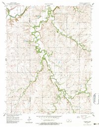
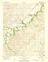
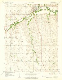
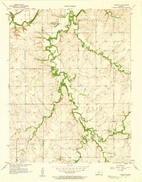
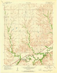
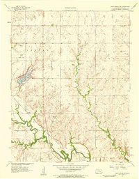
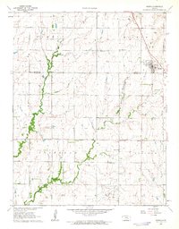
Wonsevu sits at the heart of this landscape, positioned where several drainages meet in the eastern Kansas prairie. The 1957 field survey documents a rural economy shaped by water and rail, with the Atchison Topeka and Santa Fe railroad cutting across the northwestern corner following the path of the Cottonwood River. The terrain is defined by the winding courses of Cedar Creek, Middle Creek, and Bills Creek, which carve through the townships of Doyle, Cottonwood, Cedar, and Milton. Several cemeteries, including Wonsevu Cem, Griffith Cem, and Cedar Point Cem, provide essential data points for genealogists tracing early families in the region. Local aviation history is also noted at the Clothier Landing Field, while the presence of a Gaging Station on Cedar Creek reflects the ongoing management of the area's vital water resources.
Find a feature on this map
20 named features on this map. Tap any name to fly to it.
Don’t see what you’re looking for? This feature index may not catch every label — zoom into the map to look around manually.
Map Details
Editions of this 1957 Wonsevu Map
2 editions found
Other maps of this area

1898 · Cottonwood Falls
USGS Topo · 1:125,000

1955 · Hutchinson
USGS Topo · 1:250,000
1957 · Elmdale
USGS Topo · 1:24,000
1957 · Florence
USGS Topo · 1:24,000
1957 · Wonsevu
USGS Topo · 1:24,000
1957 · Cedar Point
USGS Topo · 1:24,000
1957 · Lincolnville SW
USGS Topo · 1:24,000

1959 · Hutchinson
USGS Topo · 1:250,000

1962 · Florence SE
USGS Topo · 1:24,000
1962 · Burns
USGS Topo · 1:24,000