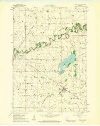
1962 Map of Wood Lake
USGS Topo · Published 1964About this map
The Yellow Medicine River winds through this 1962 landscape, flanked by the township divisions of Sandnes, Wood Lake, Lucas, and Posen. This area of southwestern Minnesota is defined by its agricultural grid and a sophisticated network of water management, including County Ditch No 9, Judicial Ditch No 10, and the expansive Sand Lake Bed. At the junction of the Great Northern and the Chicago and North Western railroads sits Hanley Falls, while the town of Wood Lake is positioned further east near the water body of the same name and Mud Lake.
Find a feature on this map
28 named features on this map. Tap any name to fly to it.
Don’t see what you’re looking for? This feature index may not catch every label — zoom into the map to look around manually.
Map Details
Editions of this 1962 Wood Lake Map
2 editions found
Other maps of this area

1953 · New Ulm
USGS Topo · 1:250,000

1957 · New Ulm
USGS Topo · 1:250,000

1958 · New Ulm
USGS Topo · 1:250,000

1962 · Wood Lake NW
USGS Topo · 1:24,000

1962 · Cottonwood
USGS Topo · 1:24,000

1962 · School Grove Lake
USGS Topo · 1:24,000

1962 · Wood Lake
USGS Topo · 1:24,000

1965 · Echo
USGS Topo · 1:24,000

1965 · Lone Tree Lake
USGS Topo · 1:24,000

1965 · Hazel Run
USGS Topo · 1:24,000