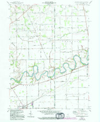
1958 Map of Woodburn North
USGS Topo · Published 1994About this map
The Maumee River winds through this landscape on the Indiana and Ohio border, carving deep oxbows as it flows past the northern edge of Woodburn. The river's historical importance as a transit corridor is visible in the path of the Erie Canal and the Wabash and Erie Canal alignment, which run parallel to the water through the southern portion of the survey. These waterways, combined with numerous drainage ditches like Marie DeLarme Creek, highlight the intensive management of this lowland region for agricultural use.
Find a feature on this map
71 named features on this map. Tap any name to fly to it.
Don’t see what you’re looking for? This feature index may not catch every label — zoom into the map to look around manually.
Map Details
Editions of this 1958 Woodburn North Map
4 editions found
Other maps of this area

1914 · Bryan
USGS Topo · 1:62,500

1914 · Paulding
USGS Topo · 1:62,500

1943 · Bryan
USGS Topo · 1:62,500

1944 · Paulding
USGS Topo · 1:62,500

1953 · Fort Wayne
USGS Topo · 1:250,000

1956 · Fort Wayne
USGS Topo · 1:250,000

1957 · Maples
USGS Topo · 1:24,000

1958 · Hicksville
USGS Topo · 1:24,000

1958 · Grabill
USGS Topo · 1:24,000

1958 · Woodburn North
USGS Topo · 1:24,000