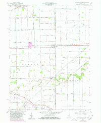
1958 Map of Woodburn South
USGS Topo · Published 1980About this map
Woodburn and Edgerton anchor the northern landscape of this Indiana-Ohio border region, where the Norfolk and Western railway cuts across a grid of agricultural lands defined by the State Line. This mid-century topography reveals a terrain shaped by water management, with a dense network of drainage channels such as Hetrick Ditch and Slusher Imbach Ditch supporting the surrounding townships of Maumee and Harrison.
Find a feature on this map
98 named features on this map. Tap any name to fly to it.
Don’t see what you’re looking for? This feature index may not catch every label — zoom into the map to look around manually.
Map Details
Editions of this 1958 Woodburn South Map

Other maps of this area

1914 · Van Wert
USGS Topo · 1:62,500

1914 · Paulding
USGS Topo · 1:62,500

1944 · Van Wert
USGS Topo · 1:62,500

1944 · Paulding
USGS Topo · 1:62,500

1953 · Fort Wayne
USGS Topo · 1:250,000

1953 · Muncie
USGS Topo · 1:250,000

1956 · Muncie
USGS Topo · 1:250,000

1956 · Fort Wayne
USGS Topo · 1:250,000

1957 · Maples
USGS Topo · 1:24,000

1958 · Grabill
USGS Topo · 1:24,000