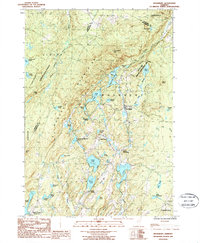
1986 Map of Woodbury
USGS Topo · Published 1987About this map
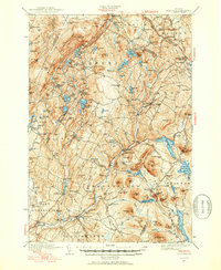
Woodbury Mountains dominate the central landscape of this 1980s Vermont survey, where a high density of glacial ponds and lakes defines the local geography. The area serves as a significant drainage basin, with the Kingsbury Branch flowing south through a chain of water bodies including Sabin Pond and Greenwood Lake. Human activity is concentrated along the north-south corridor of the main valley, connecting the settlements of Woodbury and South Woodbury.
Find a feature on this map
56 named features on this map. Tap any name to fly to it.
Don’t see what you’re looking for? This feature index may not catch every label — zoom into the map to look around manually.
Map Details
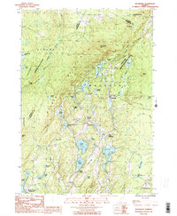
Editions of this 1986 Woodbury Map
2 editions found
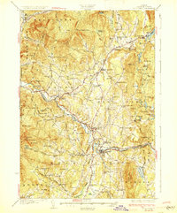
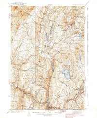
Other maps of this area

1919 · Montpelier
USGS Topo · 1:62,500

1921 · Montpelier
USGS Topo · 1:62,500

1927 · Hyde Park
USGS Topo · 1:48,000

1928 · Hardwick
USGS Topo · 1:62,500
1930 · Hyde Park
USGS Topo · 1:62,500

1934 · Hardwick
USGS Topo · 1:48,000
1938 · Hardwick
USGS Topo · 1:62,500

1939 · Plainfield
USGS Topo · 1:48,000
1940 · Plainfield
USGS Topo · 1:62,500

1943 · Plainfield
USGS Topo · 1:62,500