
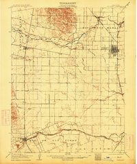
1907 Map of Woodland
USGS Topo · Published 1907About this map
The agricultural landscape of the Sacramento Valley is captured here just after the turn of the century, defined by a complex network of water management and rail connections. Woodland Browns Corners serves as the primary hub, where the Southern Pacific R R Marysville Branch intersects with a grid of irrigation canals and sloughs. Water engineering is central to this era's growth, evidenced by the Moore Dam and a series of man-made waterways like the Adams Canal and Moore Canal that divert flow from Cache Creek across the plains.
Find a feature on this map
49 named features on this map. Tap any name to fly to it.
Don’t see what you’re looking for? This feature index may not catch every label — zoom into the map to look around manually.
Map Details
Editions of this 1907 Woodland Map
2 editions found
Other maps of this area

1902 · Napa
USGS Topo · 1:125,000

1905 · Esparto
USGS Topo · 1:24,000

1907 · Dunnigan
USGS Topo · 1:62,500

1907 · Davisville
USGS Topo · 1:62,500

1908 · Vacaville
USGS Topo · 1:62,500

1908 · Courtland
USGS Topo · 1:62,500

1910 · Knights Landing
USGS Topo · 1:31,680

1915 · Yolo
USGS Topo · 1:31,680

1915 · Swingle
USGS Topo · 1:31,680

1915 · Ronda
USGS Topo · 1:31,680