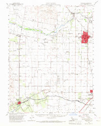
1953 Map of Woodland
USGS Topo · Published 1968About this map
Agricultural development and water management define the Yolo County landscape in this mid-century survey, anchored by the regional hub of Woodland. The map illustrates a complex network of irrigation and drainage infrastructure, including the Yolo Central Canal, Adams Canal, and Willow Slough, which supported the valley's transition into a major farming center. In the southern reaches, the Univ of Calif College of Agriculture is visible alongside Davis, while the town of Winters sits near the banks of Putah Creek. The influence of the Southern Pacific railroad is evident, with industrial spurs like the Mill Spur and Elston Spur serving local processing needs. Local history is preserved through numerous rural school sites such as Wolfskill Sch and Plainfield Union Sch, alongside landmarks like the County Fairground and the Yolo Fliers Club and Golf Course.
Find a feature on this map
64 named features on this map. Tap any name to fly to it.
Don’t see what you’re looking for? This feature index may not catch every label — zoom into the map to look around manually.
Map Details
Editions of this 1953 Woodland Map
2 editions found
Other maps of this area

1902 · Napa
USGS Topo · 1:125,000

1905 · Esparto
USGS Topo · 1:24,000

1907 · Dunnigan
USGS Topo · 1:62,500

1907 · Woodland
USGS Topo · 1:62,500

1907 · Davisville
USGS Topo · 1:62,500

1908 · Vacaville
USGS Topo · 1:62,500

1908 · Courtland
USGS Topo · 1:62,500

1910 · Knights Landing
USGS Topo · 1:31,680

1915 · Yolo
USGS Topo · 1:31,680

1915 · Swingle
USGS Topo · 1:31,680