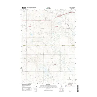
2017 Map of Woods
USGS Topo · Published 2017About this map
Farwell and the surrounding township of Surrey define the northeast corner of this Michigan landscape, where the S Br Tobacco River flows near the Mill Pond. The terrain is defined by a high concentration of glacial lakes and wetlands, including Littlefield Lake, Bluff Lake, and the evocative Deadman Lake. The southern portion of the sheet transitions into the northern reaches of Isabella County, where the N Br Chippewa River and Coldwater River snake through the countryside. For those tracing family histories in the area, the map preserves the location of Conley Cem and Gilmore Cem, as well as the small settlement of Woods. The road network, including W Ludington Dr and W Surrey Rd, provides a clear view of the rural development patterns that have shaped this region of Central Michigan.
Find a feature on this map
87 named features on this map. Tap any name to fly to it.
Don’t see what you’re looking for? This feature index may not catch every label — zoom into the map to look around manually.
Map Details
Editions of this 2017 Woods Map
This is the sole edition of this map. No revisions or reprints were ever made.
Other maps of this area

1916 · Mount Pleasant
USGS Topo · 1:62,500

1919 · Mount Pleasant
USGS Topo · 1:62,500

1943 · Mount Pleasant
USGS Topo · 1:62,500

1954 · Midland
USGS Topo · 1:250,000

1958 · Midland
USGS Topo · 1:250,000

1959 · Midland
USGS Topo · 1:250,000

1959 · Lake
USGS Topo · 1:62,500

1959 · Clare
USGS Topo · 1:62,500

1964 · Sherman City
USGS Topo · 1:24,000

1966 · Midland
USGS Topo · 1:250,000