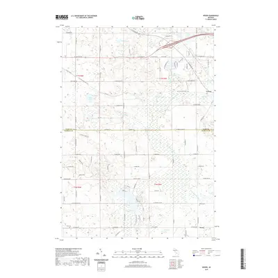
2019 Map of Woods
USGS Topo · Published 2019About this map
The village of Farwell and the settlement of Woods define the human geography of this landscape on the border of Clare and Isabella Counties. The terrain is characterized by a complex network of waterways and wetlands, including the S Br Tobacco River in the north and the Coldwater River and N Br Chippewa River to the south. Historically significant corridors like the Pere Marquette State Trail trace the path of former rail infrastructure, connecting the community of Farwell to the surrounding woodland and marshy areas such as Deadman Swamp. Local heritage is anchored by sites such as the Gilmore Cem and Conley Cem, while numerous small water bodies like Russell Lake, Minnow Lake, and Outlet Lake dot the glaciated topography. The map illustrates a rural area where small-town life meets a diverse hydraulic system of creeks and rivers flowing through central Michigan.
Find a feature on this map
47 named features on this map. Tap any name to fly to it.
Don’t see what you’re looking for? This feature index may not catch every label — zoom into the map to look around manually.
Map Details
Editions of this 2019 Woods Map
This is the sole edition of this map. No revisions or reprints were ever made.
Other maps of this area

1916 · Mount Pleasant
USGS Topo · 1:62,500

1919 · Mount Pleasant
USGS Topo · 1:62,500

1943 · Mount Pleasant
USGS Topo · 1:62,500

1954 · Midland
USGS Topo · 1:250,000

1958 · Midland
USGS Topo · 1:250,000

1959 · Midland
USGS Topo · 1:250,000

1959 · Lake
USGS Topo · 1:62,500

1959 · Clare
USGS Topo · 1:62,500

1964 · Sherman City
USGS Topo · 1:24,000

1966 · Midland
USGS Topo · 1:250,000