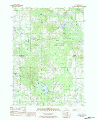
1983 Map of Woods
USGS Topo · Published 1984About this map
The Au Sable State Forest dominates the northern landscape of this 1980s survey, where the South Branch Tobacco River and Tobacco River carve through a network of glacial lakes and wetlands. The transition from the dense woodlands of Surrey township in the north to the more open township of Gilmore in the south reveals a varied terrain of high ridges and low-lying bogs like Deadman Swamp. Small-scale development is clustered around the village of Farwell, where a Mill Pond indicates earlier industrial use of the river system.
Find a feature on this map
50 named features on this map. Tap any name to fly to it.
Don’t see what you’re looking for? This feature index may not catch every label — zoom into the map to look around manually.
Map Details
Editions of this 1983 Woods Map
This is the sole edition of this map. No revisions or reprints were ever made.
Other maps of this area

1916 · Mount Pleasant
USGS Topo · 1:62,500

1919 · Mount Pleasant
USGS Topo · 1:62,500

1943 · Mount Pleasant
USGS Topo · 1:62,500

1954 · Midland
USGS Topo · 1:250,000

1958 · Midland
USGS Topo · 1:250,000

1959 · Midland
USGS Topo · 1:250,000

1959 · Lake
USGS Topo · 1:62,500

1959 · Clare
USGS Topo · 1:62,500

1964 · Sherman City
USGS Topo · 1:24,000

1966 · Midland
USGS Topo · 1:250,000
Featured Places
- Farwell, Surrey Township
- Garfield Township, MI
- Woods, Gilmore Township
- Gilmore Township, MI
- Coldwater Township, MI