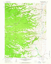
1961 Map of Woods Landing
USGS Topo · Published 1963About this map
The Laramie River valley defines the eastern edge of this landscape, serving as the primary corridor for settlements like Woods Landing and New Jelm. The area transition from the river bottom to the high timbered reaches of the Medicine Bow National Forest, where drainage systems such as Squirrel Creek and Woods Creek carve through the terrain. A notable institutional presence is found at Chimney Park Camp near Chimney Park, while the southern reaches show the early industrial and agricultural infrastructure of the Buller and Boswell Ditch. Along the western margin, the Union Pacific line cuts through the foothills, illustrating the vital rail connections that supported Wyoming's high-country ranching and timber economy. Smaller settlements such as Jelm and Boswell appear as focused points of activity amidst a network of mountain creeks and canyons.
Find a feature on this map
24 named features on this map. Tap any name to fly to it.
Don’t see what you’re looking for? This feature index may not catch every label — zoom into the map to look around manually.
Map Details
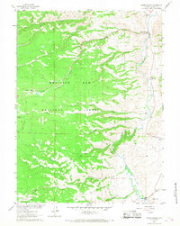
Editions of this 1961 Woods Landing Map
3 editions found
Other maps of this area

1895 · Laramie
USGS Topo · 1:125,000

1902 · Laramie
USGS Topo · 1:125,000

1905 · Laramie
USGS Topo · 1:125,000

1906 · Medicine Bow
USGS Topo · 1:125,000

1906 · Laramie
USGS Topo · 1:125,000

1908 · Laramie
USGS Topo · 1:125,000

1908 · Medicine Bow
USGS Topo · 1:125,000

1916 · Home
USGS Topo · 1:125,000

1920 · Home
USGS Topo · 1:125,000

1950 · Kings Canyon
USGS Topo · 1:24,000