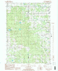
1985 Map of Woodville NE
USGS Topo · Published 1985About this map
Big Rapids marks the eastern edge of this mid-1980s landscape, where the urban boundary transitions into the extensive woodlands of the Manistee National Forest. The map captures a mix of civic infrastructure and recreational development, featuring the Roben-Hood Airport and a nearby Drive-In Theater and Trailer Park. The topography is defined by numerous water bodies and drainage systems, including Hungerford Lake, Bisel Lake, and the winding paths of Mitchell Creek and Mc Duffee Creek. Extractive industry and land management are evident through several Gravel Pits and a Borrow Pit scattered across the township lines. This survey provides a look at the rural character of the Newaygo and Mecosta County border, highlighting established sites such as a local Cem and a Public Golf Course situated near the growing corporate limits.
Find a feature on this map
30 named features on this map. Tap any name to fly to it.
Don’t see what you’re looking for? This feature index may not catch every label — zoom into the map to look around manually.
Map Details
Editions of this 1985 Woodville NE Map
2 editions found
Other maps of this area

1954 · Midland
USGS Topo · 1:250,000

1958 · Midland
USGS Topo · 1:250,000

1958 · Woodville
USGS Topo · 1:62,500

1958 · Big Rapids
USGS Topo · 1:62,500

1959 · Midland
USGS Topo · 1:250,000

1959 · Evart
USGS Topo · 1:62,500

1959 · Reed City
USGS Topo · 1:62,500

1966 · Midland
USGS Topo · 1:250,000

1976 · Evart SW
USGS Topo · 1:24,000

1976 · Big Rapids SW
USGS Topo · 1:24,000