
1955 Map of Woodward
USGS Topo · Published 1967About this map
The Cimarron River and North Canadian River valleys define the geography of northwest Oklahoma and portions of the Kansas and Texas borders during the mid-1960s. Major infrastructure like the Western Oklahoma State Hospital in Woodward and the Kegelman AF military facility near Alva anchor the regional economy. This era shows a landscape managed by extensive water projects, including the Fort Supply Reservoir on Wolf Creek and the Great Salt Plains Reservoir, which supports the Great Salt Plains National Wildlife Refuge.
Find a feature on this map
132 named features on this map. Tap any name to fly to it.
Don’t see what you’re looking for? This feature index may not catch every label — zoom into the map to look around manually.
Map Details
Editions of this 1955 Woodward Map
3 editions found
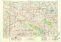
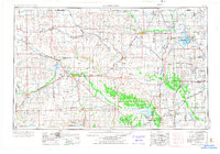
Other maps of this area

1889 · Anthony
USGS Topo · 1:125,000

1889 · Caldwell
USGS Topo · 1:125,000

1891 · Medicine Lodge
USGS Topo · 1:125,000

1891 · Anthony
USGS Topo · 1:125,000

1892 · Meade
USGS Topo · 1:125,000

1892 · Coldwater
USGS Topo · 1:125,000

1892 · Kingfisher
USGS Topo · 1:125,000

1893 · Hennessey
USGS Topo · 1:62,500

1893 · Caldwell
USGS Topo · 1:125,000

1893 · Medicine Lodge
USGS Topo · 1:125,000