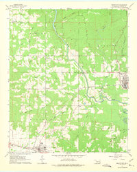
1962 Map of Wright City
USGS Topo · Published 1975About this map
The timber and rail corridors of McCurtain County are clearly defined in this early 1960s study, anchored by the industrial activity in Wright City and the agricultural hub of Valliant. The Texas and Oklahoma Eastern Railroad serves as a primary axis across the landscape, connecting these settlements while tracing the path of the Little River and its various branches, including the Sulphur Little River. The map captures a moment of established rural life, evidenced by a network of local landmarks such as White Sands Ch and several family or community burial grounds like Moran Cem and Felker Cem.
Find a feature on this map
34 named features on this map. Tap any name to fly to it.
Don’t see what you’re looking for? This feature index may not catch every label — zoom into the map to look around manually.
Map Details
Editions of this 1962 Wright City Map
3 editions found

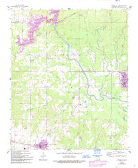
Other maps of this area

1901 · Alikchi
USGS Topo · 1:125,000

1902 · Lukfata
USGS Topo · 1:125,000

1950 · Mcalester
USGS Topo · 1:250,000

1951 · Garvin
USGS Topo · 1:24,000

1951 · Millerton
USGS Topo · 1:24,000

1951 · Kiomatia
USGS Topo · 1:24,000

1953 · Texarkana
USGS Topo · 1:250,000

1956 · Texarkana
USGS Topo · 1:250,000

1959 · Golden
USGS Topo · 1:62,500

1962 · McAlester
USGS Topo · 1:250,000