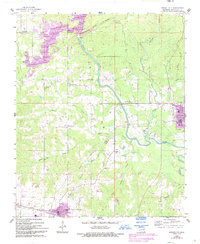
1962 Map of Wright City
USGS Topo · Published 1993About this map
Little River winds through this Oklahoma landscape, anchoring a rural network of timber-country settlements and water features. The map captures the area around Wright City and Valliant during a period of transition, where established rural communities like Mound Grove and Plainview sit alongside infrastructure like the Gaging Station and a Pumping Station. Of particular interest to local historians is the documentation of family and community spaces, including the Moran Cem and White Sands Ch. The northwestern corner is dominated by the waters of Pine Creek Lake, while the central terrain is marked by Rough Hollow and Sand Ridge. The 1990s revisions, noted in purple, illustrate subtle shifts in the built environment, such as the appearance of a Drive-in Theater and expanded residential footprints in the primary townships.
Find a feature on this map
28 named features on this map. Tap any name to fly to it.
Don’t see what you’re looking for? This feature index may not catch every label — zoom into the map to look around manually.
Map Details
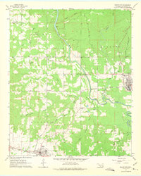
Editions of this 1962 Wright City Map
3 editions found

Other maps of this area

1901 · Alikchi
USGS Topo · 1:125,000

1902 · Lukfata
USGS Topo · 1:125,000

1950 · Mcalester
USGS Topo · 1:250,000

1951 · Garvin
USGS Topo · 1:24,000

1951 · Millerton
USGS Topo · 1:24,000

1951 · Kiomatia
USGS Topo · 1:24,000

1953 · Texarkana
USGS Topo · 1:250,000

1956 · Texarkana
USGS Topo · 1:250,000

1959 · Golden
USGS Topo · 1:62,500

1962 · McAlester
USGS Topo · 1:250,000