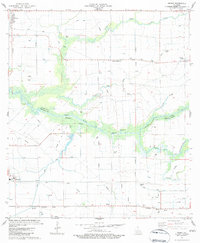
1983 Map of Wright
USGS Topo · Published 1983About this map
Bayou Queue De Tortue meanders across this landscape, defining the boundary between Acadia and Vermilion Parishes. In the early 1980s, this region of south Louisiana displays a complex network of man-made waterways like the Avrico Canal, Maree Canal, and Michel Canal, which support the agricultural and petroleum infrastructure of the coastal prairie. The Southern Pacific railroad cuts through the settlements of Morse, Wright, and Mulvey, anchoring the local economy to the rail lines. Small family-named landmarks and cemeteries, including Hanks Cem, Simon Cem, and Leger Cem, are scattered throughout the rural tracts, providing essential markers for genealogists tracing heritage in these prairie communities. The presence of numerous gas wells and the Merrit Landing Strip further illustrates the industrial and transit character of the area during this period.
Find a feature on this map
29 named features on this map. Tap any name to fly to it.
Don’t see what you’re looking for? This feature index may not catch every label — zoom into the map to look around manually.
Map Details
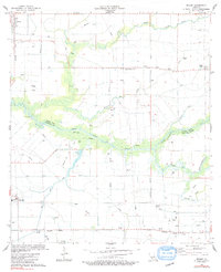
Editions of this 1983 Wright Map
2 editions found
Other maps of this area

1946 · Morse
USGS Topo · 1:31,680

1946 · Schooner Bayou NE
USGS Topo · 1:31,680

1946 · Schooner Bayou NW
USGS Topo · 1:31,680

1946 · Mermentau
USGS Topo · 1:31,680

1946 · Kaplan
USGS Topo · 1:31,680

1946 · Rayne
USGS Topo · 1:31,680

1949 · Gueydan
USGS Topo · 1:31,680

1949 · Estherwood
USGS Topo · 1:31,680

1952 · Lake Charles
USGS Topo · 1:250,000
1954 · Schooner Bayou NW
USGS Topo · 1:31,680