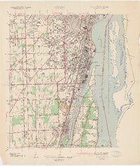
1942 Map of Wyandotte
USGS Topo · Published 1942About this map
Wyandotte and the downriver Detroit communities are defined here by a dense industrial and maritime corridor just before the heavy wartime expansion of the early 1940s. The shoreline is a complex network of shipping lanes and islands, including the massive Fighting Island and the residential and recreational landscape of Grosse Ile. Inland, the transition from urban centers like Lincoln Park to the smaller settlements of Woodland Acres and Goddard Farms is marked by an extensive grid of drains, such as the Frank and Poet Drain, essential for managing the low-lying terrain near the Detroit River.
Find a feature on this map
59 named features on this map. Tap any name to fly to it.
Don’t see what you’re looking for? This feature index may not catch every label — zoom into the map to look around manually.
Map Details
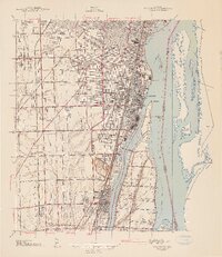
Editions of this 1942 Wyandotte Map
2 editions found
Other maps of this area

1905 · Wayne
USGS Topo · 1:62,500

1905 · Detroit
USGS Topo · 1:62,500

1906 · Wyandotte
USGS Topo · 1:62,500

1906 · Romulus
USGS Topo · 1:62,500

1912 · Wyandotte
USGS Topo · 1:62,500

1912 · Wayne
USGS Topo · 1:62,500

1918 · Detroit
USGS Topo · 1:62,500

1924 · Detroit
USGS Topo · 1:62,500

1928 · Romulus
USGS Topo · 1:62,500

1929 · Wyandotte
USGS Topo · 1:62,500