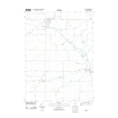
2012 Map of Wyanet
USGS Topo · Published 2012About this map
Wyanet stands at the northern edge of this Bureau County landscape, where the local street grid including S Locust St and Maple St meets the historic Towpath Rd. To the south, the village of Tiskilwa sits near the confluence of Rocky Run and Big Bureau Cr, showing a detailed layout of roads like W Main St and N Galena St. The region is defined by the winding course of W Bureau Cr and its various tributaries, which cut through the agricultural surroundings. Several family and community burial grounds, such as Forest Hill Cem and Mount Bloom Cem, are preserved here, providing essential data for genealogists tracing early settlers. Between these primary settlements, the map documents smaller locales like Providence and recreation sites such as Camp Menno-Haven near Menno-Haven Lake, alongside rural infrastructure like Eckberg Airport.
Find a feature on this map
82 named features on this map. Tap any name to fly to it.
Don’t see what you’re looking for? This feature index may not catch every label — zoom into the map to look around manually.
Map Details
Editions of this 2012 Wyanet Map
This is the sole edition of this map. No revisions or reprints were ever made.
Other maps of this area

1893 · Lacon
USGS Topo · 1:62,500

1893 · Hennepin
USGS Topo · 1:62,500

1909 · Hennepin
USGS Topo · 1:62,500

1911 · Hennepin
USGS Topo · 1:62,500

1921 · Buda
USGS Topo · 1:62,500

1923 · Buda
USGS Topo · 1:62,500

1933 · Lacon
USGS Topo · 1:62,500

1933 · Camp Grove
USGS Topo · 1:48,000

1937 · Lacon
USGS Topo · 1:62,500

1945 · Bradford
USGS Topo · 1:62,500