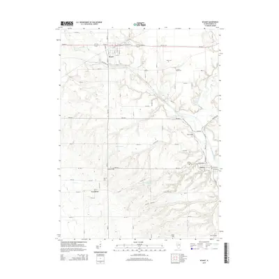
2015 Map of Wyanet
USGS Topo · Published 2015About this map
Wyanet serves as a focal point in the northern portion of this Bureau County landscape, where the prairie begins to break into the drainage systems of Big Bureau Creek. The settlement of Tiskilwa occupies the southeastern corner, tucked against the bluffs near Twin Faun Lake and Plow Hollow. This area is particularly rich for genealogical research, as evidenced by numerous burial sites including Forest Hill Cem, Catholic Cem, and the County Home Cem. The landscape is defined by its watercourses, from the broad W Bureau Cr to smaller tributaries like Coal Cr and Rocky Run. Traces of the region's infrastructure are visible along Tow Path Rd, reflecting the historic transportation corridors that followed the natural contours of the Bureau Creek valley. Away from the larger villages, the small community of Providence remains a landmark amidst the agricultural grid and the wooded breaks of Cedar Bluff.
Find a feature on this map
50 named features on this map. Tap any name to fly to it.
Don’t see what you’re looking for? This feature index may not catch every label — zoom into the map to look around manually.
Map Details
Editions of this 2015 Wyanet Map
This is the sole edition of this map. No revisions or reprints were ever made.
Other maps of this area

1893 · Lacon
USGS Topo · 1:62,500

1893 · Hennepin
USGS Topo · 1:62,500

1909 · Hennepin
USGS Topo · 1:62,500

1911 · Hennepin
USGS Topo · 1:62,500

1921 · Buda
USGS Topo · 1:62,500

1923 · Buda
USGS Topo · 1:62,500

1933 · Lacon
USGS Topo · 1:62,500

1933 · Camp Grove
USGS Topo · 1:48,000

1937 · Lacon
USGS Topo · 1:62,500

1945 · Bradford
USGS Topo · 1:62,500