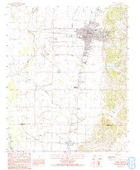
1984 Map of Wynne
USGS Topo · Published 1993About this map
The rising elevations of Crowleys Ridge dominate the eastern portion of this Arkansas landscape, creating a distinct upland contrast to the flatter alluvial plains to the west. The city of Wynne serves as the primary hub, where numerous rail lines and roads converge at the edge of the ridge's foot. Moving south toward the Cross and St. Francis County line, the map documents smaller rural communities and crossing points like Fitzgerald Crossing, Wilkins, and Colt.
Find a feature on this map
24 named features on this map. Tap any name to fly to it.
Don’t see what you’re looking for? This feature index may not catch every label — zoom into the map to look around manually.
Map Details
Editions of this 1984 Wynne Map
2 editions found
Other maps of this area

1939 · Vanndale
USGS Topo · 1:62,500

1939 · Wynne
USGS Topo · 1:62,500

1940 · Princedale
USGS Topo · 1:62,500

1940 · Whitmore
USGS Topo · 1:62,500

1953 · Memphis
USGS Topo · 1:250,000

1956 · Memphis
USGS Topo · 1:250,000

1956 · Whitmore
USGS Topo · 1:62,500

1956 · Princedale
USGS Topo · 1:62,500

1958 · Wynne
USGS Topo · 1:62,500

1958 · Vanndale
USGS Topo · 1:62,500