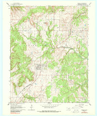
1964 Map of Wynona
USGS Topo · Published 1988About this map
Wynona Oil Field and Pershing Oil Field dominate the mid-1960s landscape of Osage County, revealing an economy deeply rooted in petroleum extraction. Numerous oil wells are scattered throughout the hills, particularly concentrated near the settlement of Wynona and along the Missouri - Kansas - Texas railroad line. The grid-like layout of Wynona contrasts with the surrounding terrain, which is marked by features like Wooster Mound and the winding course of Birch Creek. To the north, the small community of Pershing sits near the Strike Axe boundary, while St Josephs Cem serves as a local landmark. The presence of Big Heart Oil Field and Birch Creek South Oil Field further indicates the extensive industrial footprint of the era, where energy production and rail transport defined the region's development.
Find a feature on this map
23 named features on this map. Tap any name to fly to it.
Don’t see what you’re looking for? This feature index may not catch every label — zoom into the map to look around manually.
Map Details
Editions of this 1964 Wynona Map
2 editions found
Other maps of this area

1906 · Nelagoney
USGS Topo · 1:24,000

1909 · Pawhuska
USGS Topo · 1:125,000

1910 · Pawhuska
USGS Topo · 1:125,000

1912 · Hominy
USGS Topo · 1:125,000

1915 · Hominy
USGS Topo · 1:125,000

1915 · Hominy
USGS Topo · 1:62,500

1955 · Enid
USGS Topo · 1:250,000

1958 · Enid
USGS Topo · 1:250,000

1960 · Nelagoney
USGS Topo · 1:24,000

1960 · Pawhuska
USGS Topo · 1:24,000