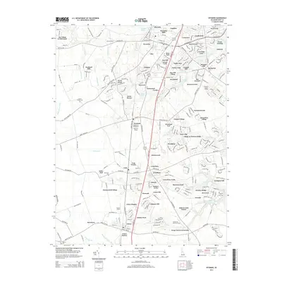
2014 Map of Wyoming
USGS Topo · Published 2014About this map
Wyoming and Camden serve as the central hubs for this region of Kent County, where residential development in neighborhoods like Royal Grant and Briar Park meets a landscape defined by its historic watercourses. The drainage of Tidbury Cr and the Murderkill River shaped early industry here, as evidenced by Wyoming Mills and Voshell Mill. For family historians, several small burial grounds are marked, including Kingdom Holiness Cem, Downham Cem, and Hopkins Cem, alongside the prominent Barratt's Chapel. The map reveals a high density of small-craft aviation, with Jenkins Airport, Doyle's Airport, and Henderson Aviation Airport all situated within a few miles of each other. This layout demonstrates the 21st-century transition of the area from a purely agrarian mill-economy into a complex network of suburban subdivisions and private infrastructure.
Find a feature on this map
293 named features on this map. Tap any name to fly to it.
Don’t see what you’re looking for? This feature index may not catch every label — zoom into the map to look around manually.
Map Details
Editions of this 2014 Wyoming Map
This is the sole edition of this map. No revisions or reprints were ever made.
Other maps of this area

1899 · Vineland
USGS Topo · 1:125,000

1899 · Dover
USGS Topo · 1:125,000

1906 · Dover
USGS Topo · 1:125,000

1918 · Cedar Creek
USGS Topo · 1:62,500

1918 · Harrington
USGS Topo · 1:62,500

1919 · Cedar Creek
USGS Topo · 1:62,500

1919 · Vineland
USGS Topo · 1:125,000

1920 · Dover
USGS Topo · 1:125,000

1926 · Wyoming
USGS Topo · 1:48,000

1930 · Wyoming
USGS Topo · 1:62,500