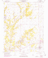
1968 Map of Xenia
USGS Topo · Published 1978About this map
The village of Xenia stands as a focal point of this Southern Illinois landscape, situated at the junction of the Baltimore and Ohio and Illinois Central Gulf railroads. This era of the late 1960s and 1970s shows the region's heavy reliance on the Xenia Oil Field, with numerous oil wells dotting the township lines of Songer, Omega, and Iuka. The terrain is deeply incised by Skillet Fork and its many tributaries, including Crabapple Branch and Bickle Branch, which dictate the rural road network and the placement of early family settlements.
Find a feature on this map
42 named features on this map. Tap any name to fly to it.
Don’t see what you’re looking for? This feature index may not catch every label — zoom into the map to look around manually.
Map Details
Editions of this 1968 Xenia Map
2 editions found
Other maps of this area

1934 · Salem
USGS Topo · 1:62,500

1938 · Salem
USGS Topo · 1:62,500

1945 · Kinmundy
USGS Topo · 1:62,500

1947 · Kinmundy
USGS Topo · 1:62,500

1952 · Xenia
USGS Topo · 1:62,500

1956 · Edgewood
USGS Topo · 1:62,500

1958 · Belleville
USGS Topo · 1:250,000

1962 · Belleville
USGS Topo · 1:250,000

1965 · Iuka
USGS Topo · 1:24,000
1965 · Omega
USGS Topo · 1:24,000