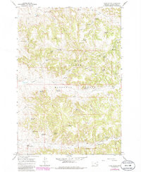
1967 Map of Yager Butte
USGS Topo · Published 1986About this map
Custer National Forest encompasses the rugged landscape of Powder River County, defined by a network of drainage basins and high ridges. The area is anchored by Yager Butte, which serves as a significant vantage point with its Lookout Tower. The terrain is characterized by numerous seasonal and permanent water sources essential for land management and ranching, such as Shorty Creek Reservoir, Cloudburst Reservoir, and Erickson Reservoir.
Find a feature on this map
49 named features on this map. Tap any name to fly to it.
Don’t see what you’re looking for? This feature index may not catch every label — zoom into the map to look around manually.
Map Details
Editions of this 1967 Yager Butte Map
2 editions found
Other maps of this area

1954 · Hardin
USGS Topo · 1:250,000

1954 · Ekalaka
USGS Topo · 1:250,000

1956 · Ekalaka
USGS Topo · 1:250,000

1957 · Hardin
USGS Topo · 1:250,000

1958 · Ekalaka
USGS Topo · 1:250,000

1958 · Hardin
USGS Topo · 1:250,000

1965 · Ekalaka
USGS Topo · 1:250,000

1966 · Goodspeed Butte
USGS Topo · 1:24,000

1966 · Coleman Draw
USGS Topo · 1:24,000

1966 · Home Creek Butte
USGS Topo · 1:24,000