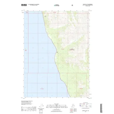
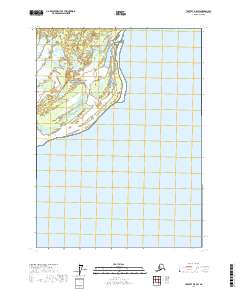
2017 Map of Yakutat D-5 SE
USGS Topo · Published 2017About this map
Tongass National Forest dominates the eastern half of this coastal landscape, where the rugged topography of the Saint Elias Mountains meets the Gulf of Alaska. Along the western shoreline, Yakutat Bay serves as a prominent maritime feature, bordered by the steep elevations of Logan Bluffs and the coastal expanse of Logan Beach. The map illustrates the dynamic glacial environment of the region, specifically marking the Latouche Glacier as it descends toward the coastal lowlands. To the south, the peak of Mt Hoorts anchors the inland terrain, while smaller drainage systems like Aquadulce Cr cut through the heavily contoured wilderness. This 2017 survey reflects a largely undeveloped stretch of the Alaskan panhandle, emphasizing the intersection of high alpine ice fields and the complex shoreline of the Pacific northwest.
Find a feature on this map
13 named features on this map. Tap any name to fly to it.
Don’t see what you’re looking for? This feature index may not catch every label — zoom into the map to look around manually.
Map Details
Editions of this 2017 Yakutat D-5 SE Map
This is the sole edition of this map. No revisions or reprints were ever made.
Other maps of this area

1951 · Yakutat
USGS Topo · 1:250,000

1959 · Yakutat C-5
USGS Topo · 1:63,360

1959 · Yakutat D-4
USGS Topo · 1:63,360

1959 · Yakutat C-4
USGS Topo · 1:63,360

1959 · Yakutat D-5
USGS Topo · 1:63,360

1959 · Yakutat
USGS Topo · 1:250,000
1996 · Yakutat C-5
USGS Topo · 1:63,360
1997 · Yakutat C-4
USGS Topo · 1:63,360
2017 · Yakutat D-4 SW
USGS Topo · 1:25,000
2017 · Yakutat D-5 SW
USGS Topo · 1:25,000