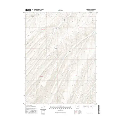
2016 Map of Yankee Gulch
USGS Topo · Published 2016About this map
Wagonroad Ridge dominates the central topography of this Rio Blanco County terrain, serving as a high divide between several significant drainages. The landscape is defined by an intricate network of deep gulches and canyons, including the namesake Yankee Gulch and the extensive Ryan Gulch to the north. These natural corridors were historically vital for movement through the high country, as evidenced by the county road system following the contours of the land. Waterways such as Black Sulphur Creek and Eureka Creek carve through the southern sections, while specialized features like Stake Springs Draw suggest local water sources critical for livestock and early travelers. The map reveals a transition in naming conventions and geography, from the arid stretches of Dry Ryan Gulch to the more complex headwaters of W Fawn Creek and E Fawn Creek in the southeast corner.
Find a feature on this map
26 named features on this map. Tap any name to fly to it.
Don’t see what you’re looking for? This feature index may not catch every label — zoom into the map to look around manually.
Map Details
Editions of this 2016 Yankee Gulch Map
This is the sole edition of this map. No revisions or reprints were ever made.
Other maps of this area

1929 · Highmore
USGS Topo · 1:62,500

1952 · Wolf Ridge
USGS Topo · 1:24,000

1952 · Yankee Gulch
USGS Topo · 1:24,000

1952 · Rock School
USGS Topo · 1:24,000

1952 · Square S Ranch
USGS Topo · 1:24,000

1956 · Grand Junction
USGS Topo · 1:250,000

1959 · Grand Junction
USGS Topo · 1:250,000

1960 · Grand Junction
USGS Topo · 1:250,000

1962 · Grand Junction
USGS Topo · 1:250,000

1964 · Grand Junction
USGS Topo · 1:250,000